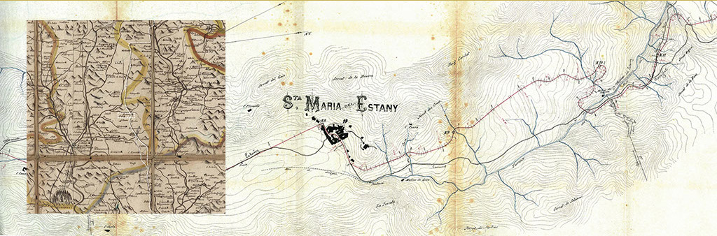
From early medieval times onwards, the monastery made efforts to control the water in the lake by means of a network of channels and ditches. There still exist details of the maintenance work carried out on this network as early as the year 1554. This project aimed to improve sanitation in the area, create more cultivatable land, increase agricultural production and collect more taxes.

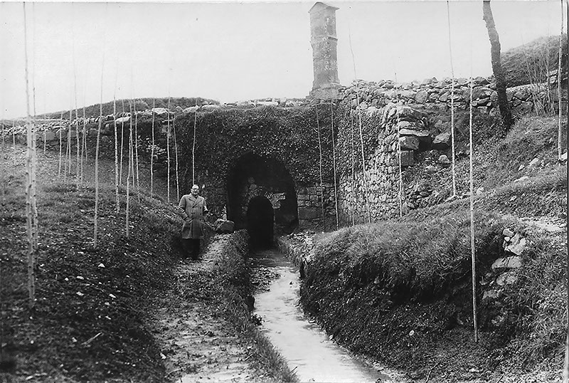
The lake was dried up definitively between 1734 and 1737 as the result of an engineering project to construct a drainage ditch. The work involved in building this new infrastructure consisted of running the original main canal underground and covering it and also increasing the gradient of the overflow to guarantee that the entire volume of water in the lake would drain out.

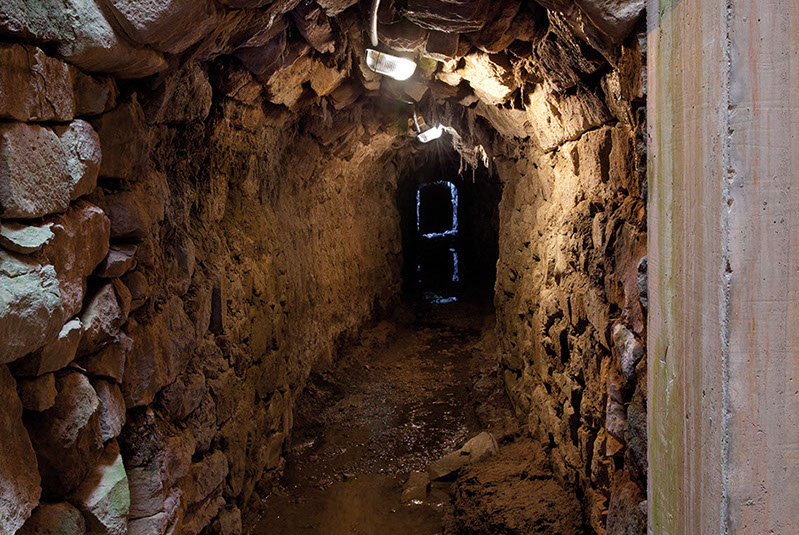
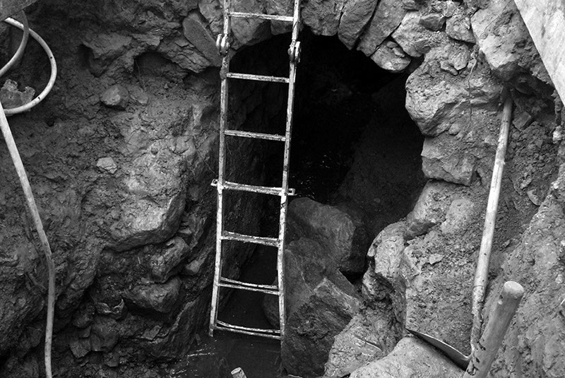
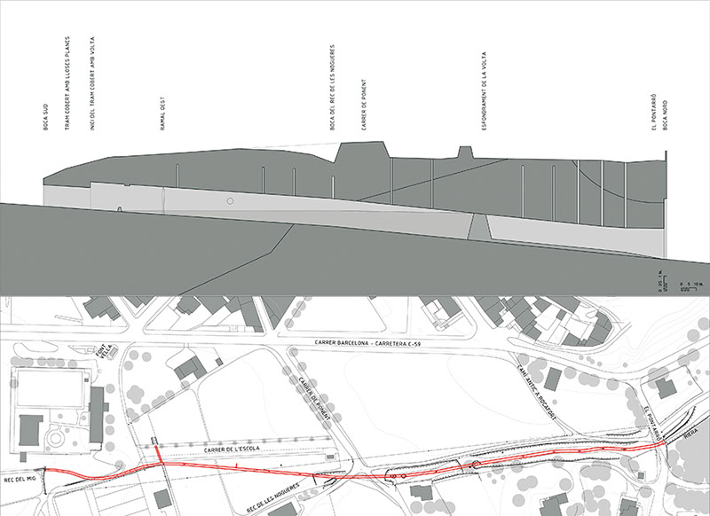
The total length of the drainage ditch is 425m and its main lower section, which is 390m long, is covered by a barrel vault built of rocks and held in place without mortar in the form of the pages of a bound book. The rest of the higher section of the drainage ditch, which is some 35m long, is trabeated, or covered by large flat stone slabs resting without mortar on the side walls.

After almost three centuries the drainage ditch still performs its original function, ensuring that the water does not become stagnant, making it circulate and thereby preventing the lake from reappearing. For some years the existence of the ditch was forgotten, but it has now been rediscovered and has once again become an important part of the cultural heritage of L’Estany.

Ajuntament de L'Estany

Boca nord de la Mina i Pontarró, 1946.

Fons Raimon Mauri.

Ajuntament de L'Estany

Interior de la mina, 2015

Ajuntament de L'Estany

Interior de la mina, 2012

Ajuntament de L'Estany

Secció longitudinal de la Mina, 2010.

Transforming the land

During the Middle Ages the territory was marked as having been transformed by man and was defined by the monastery, the village, the farmhouses, the fields, the woodlands and the lake. The local landscape was characterized by large-scale agriculture complemented by intensive livestock farming.

In the modern age L’Estany expanded in size and more land was needed. Consequently, the lake was dried up and large areas of woodland were cleared and replaced with dry stone terraces to facilitate cultivation on sloping land. The need for land was pressing and any piece of land that could be cultivated was exploited.

In those days, the territory was structured by a number of roads which aided communication, the exchange of ideas and, above all, the circulation of goods. The old transhumance routes that connected the summer pastures in the Pyrenees to the winter pastures in Vallès played a fundamental role in the evolution of the village as L’Estany was on the route of these long seasonal journeys.

The economic transformations of the twentieth century brought about an abrupt break with the past. The rural landscape then underwent rapid urbanisation which modified its characteristics. On either side of the village a landscape of terraces and the ruins of old constructions can be discovered hidden in the woodland, which have regenerated and once again spread over much of the hillside.

El domini de la terra

1824 - Fragment del mapa “Nueva descripción geográfica del principado de Cataluña”.

Autor: Ramon Yndar / D. Estruc (gravat).

Font: Cartoteca Institut Cartogràfic de Catalunya

1882 - Planta del “Proyecto de carretera provincial de Moyà a Calaf por Suria”.

Autor: enginyer desconegut.

Font: Arxiu Històric de la Diputació de Barcelona

Ajuntament de L'Estany

Plaça Major, 1930.

Fons Assumpta Rafel.

Ajuntament de L'Estany

El poble des del camí ral, 1910

Fons Assumpta Rafel.

Ajuntament de L'Estany

El poble des del camí ral, 1930

Fons Assumpta Rafel.

Ajuntament de L'Estany

El poble des del costat de la Mina, 1930

Fons Assumpta Rafel.

This website uses proprietary and third-party cookies to improve the browsing experience as well as for analysis. By continuing browsing, we understand that you agree the use of cookies

What are cookies?

A cookie is a small file stored on the user's computer that allows us to recognize it. The set of cookies help us improve the quality of our website, allowing us to monitor which pages are useful to the website users or and which are not.

Cookies are essential for the operation of the Internet, providing innumerable advantages in the provision of interactive services, providing us with the navigation and usability of our website. Please note that cookies can not harm your computer and, if enabled, they help us identify and resolve errors.

What kind of cookies are used in this site?

Propietary cookies: those that are sent to the user's computer from a computer or domain managed by the publisher and from which provides the service requested by the user.

Third party cookies:those that are sent to the user's computer from a computer or domain not managed by the publisher but by another entity that analyzes the data collected. .

Persisting cookies: a type of cookie in which data are still stored in the terminal and can be accessed and processed by the cookie's responsible.

Analytics cookies: using web analytics to get information on the number of users accessing the site, number of pages viewed, and repetition frequency of visits, the duration, the browser used, operator who provides the service, the language used by the terminal or the city to which is assigned the IP address. Information that allows a better and more appropriate service by this website.

Accept the use of cookies.

We assume that you accept cookies. However, you can restrict, block or erase cookies from this site or any page from the browser settings.

Next you can find the main browsers help pages: